
INDIA
The Indian continent is traditionally shown on plate tectonic reconstructions to be an island continent migrating north during the Mesozoic Era, moving across a vast pre-
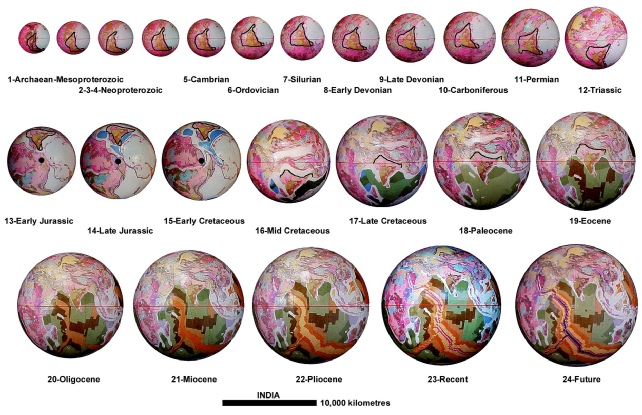
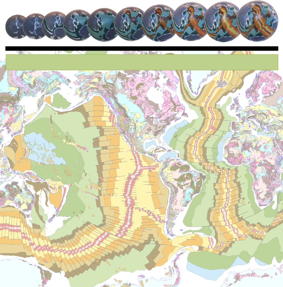
The continental crustal development of India on an Expansion Tectonic Earth. Each of the early-
In contrast, the crustal development of India during Precambrian times on an Expansion Tectonic Earth initially formed a southern extension of the European and Asian Tethys Sea basin. During that time, and extending into later Palaeozoic times, India was located adjacent to East Antarctica to the northeast, Madagascar and South Africa to the southwest, and Arabia to the west. The ancient crust making up the present Indian continent was originally located within mid-
During the Mesozoic, India briefly migrated into mid-
Crustal extension between the ancient north and south Indian crustal regions occurred during the Proterozoic Eon in conjunction with related crustal development in the Tethys region. This period of crustal extension continued into the Mesozoic Era. Crustal movement and mountain building in India was associated with crustal motion relative to Antarctica, Madagascar, and Africa, as well as a number of Palaeozoic to Cenozoic mountain building events along the northern Himalayan contact with Europe and Asia. In this context the Himalayan Mountain chain was intimately associated with changes to surface curvature focused along this northern Himalayan contact.
Continental separation and rifting of India, Madagascar, and Sri Lanka from Antarctica and Africa commenced in the Jurassic during initial opening of the Indian Ocean. Madagascar and Sri Lanka then began drifting away from India during the early-
In contrast to plate tectonic reconstructions, on an Expansion Tectonic Earth the Indian continent has remained geologically attached to the Asian continent throughout all Earth history.
Because of the proximity of India to the European and Asian Tethys Sea region, India was geographically, but not geologically, isolated from Asia for much of that time by the presence of shallow continental seas. As the European and Asian Tethys Sea progressively drained during the Cenozoic Era, India and Asia were then fully exposed as one continuous continental plate with no requirement for a separate Indian sub-